
9/5/2003
33.824, -98.544  994 ft.
Transparency 3/5  seeing 3/5
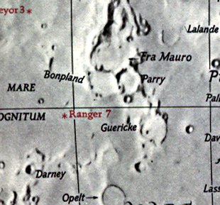
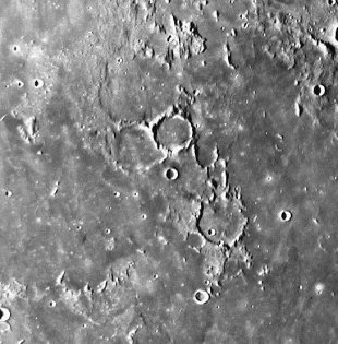
Later at 5:30 UT I made my way north to the region west of Parry. The high plains of northern Bonpland were crossed by a thin ray from a break in the western rim of Parry just short of 8 degrees south. It was hair fine and extended ~25Km to the west where the tips of the shadowed peaks met the depths of blackness at the terminator.-David Ryle
Using the Lunar Observer's Toolkit:
Site Longitude = +98.544
Site Latitude = +33.824
Site Elevation = +252.000

Reproducing Lighting For: 2003/9/5 at 05:30 U.T.

Desired Solar Altitude =  +0.868(Rising),  Azimuth = +88.397

Feature = BONPLAND
Feature Longitude: = -17.400
Feature  Latitude: =  -8.300

Average Co-longitude =  18.277

Moon's Altitude Restricted = Y Altitude =  +5.000 degrees

In the Time column, D=Daylight, T=Twilight

                      ---- Moon's ----    -- Earth's --
                        Topocentric        Topocentric      -------- Sun's --------
   UT Date    Time     Alt°   Semi-Diam''  Long°   Lat°     Colong°     Lat°    Azim°

 2003/09/05  05:30   +11.374    966.90    +3.018  +5.021    018.491   +1.461  +88.397
Bonpland -293,-147: A fine example of a large ringed-plain. Of the southern wall face the Mare, only isolated fragments remain; the other portions are continuous but low. On the interior are some craterlets and hillocks. Three clefts also traverse the interior; the most easterly commences at the crater, D, skirts a small but easily seen buried ring adjoining the wall, and, after reaching one of the remaining fragments, reappears beyond, and crosses the floor to Fra Mauro. The second cleft begins at the crater, C, and dies out on the floor. The third cleft begins at the south wall, and after running across the floor enters Fra Mauro by a gap... - Wilkins and Moore, The Moon, Faber and Faber Ltd, 1955

